MEETING POINT: 6:00 AM in Como
DAY 1:
15 km | 1,800 m D+
From San Bartolomeo (1,207 m), we follow the mule track leading to Alpe di Mezzo. To our right towers Monte Berlinghera, while our route turns left towards Sasso Canale.
The ascent is steady and rewarding: we first reach the area below Sasso Bianco (2,397 m) before the summit of Sasso Canale (2,411 m) comes into view, which we conquer before continuing along the ridge.
A short descent and some rolling terrain allow us to catch our breath, but the path remains consistently challenging and demands focus. We reach the base of Pizzo Ledù (2,505 m), where we tackle the spectacular and vertical Ferrata del Ledù, which takes us to 2,440 m—the highest point of the first stage.
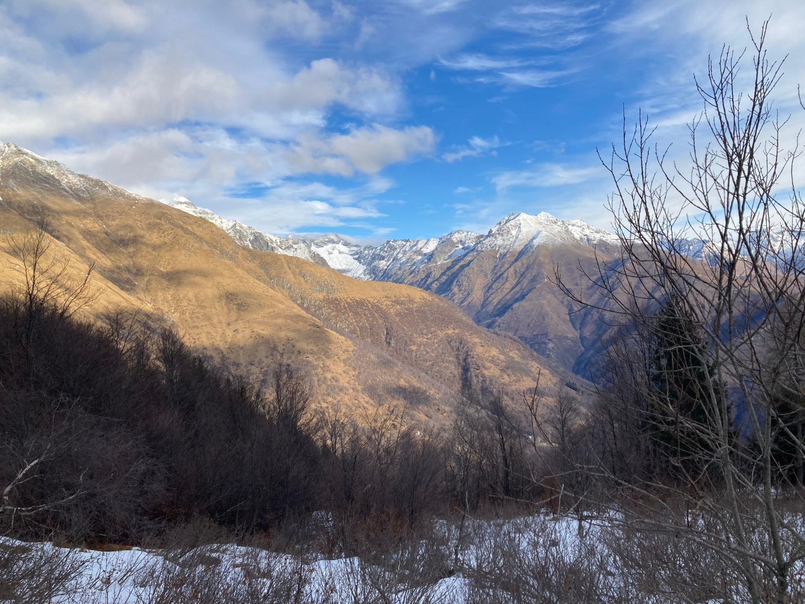
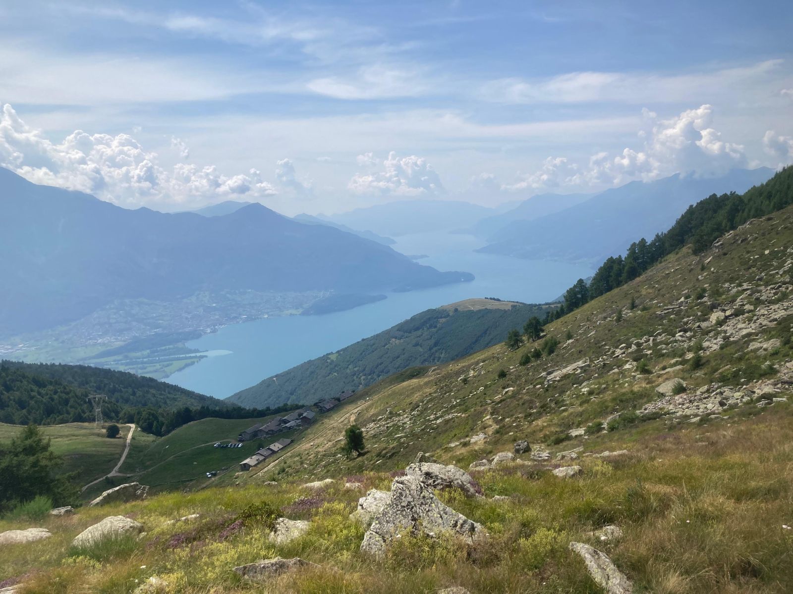
After passing the halfway mark, we head toward Lago Ledù (2,245 m), next to which stands the characteristic Bivacco Petazzi. A brief stop lets us admire the magnificent panorama: to the south, Lake Como; to the north, Val Chiavenna from Bocchetta del Cannone.
We continue through the high slopes of Val d’Inghirina, often lit up by the colors of rhododendrons. Passing Lago di Cavrig (2,130 m), also known as the “frog lake,” we reach Bocchetta di San Pio (2,178 m).
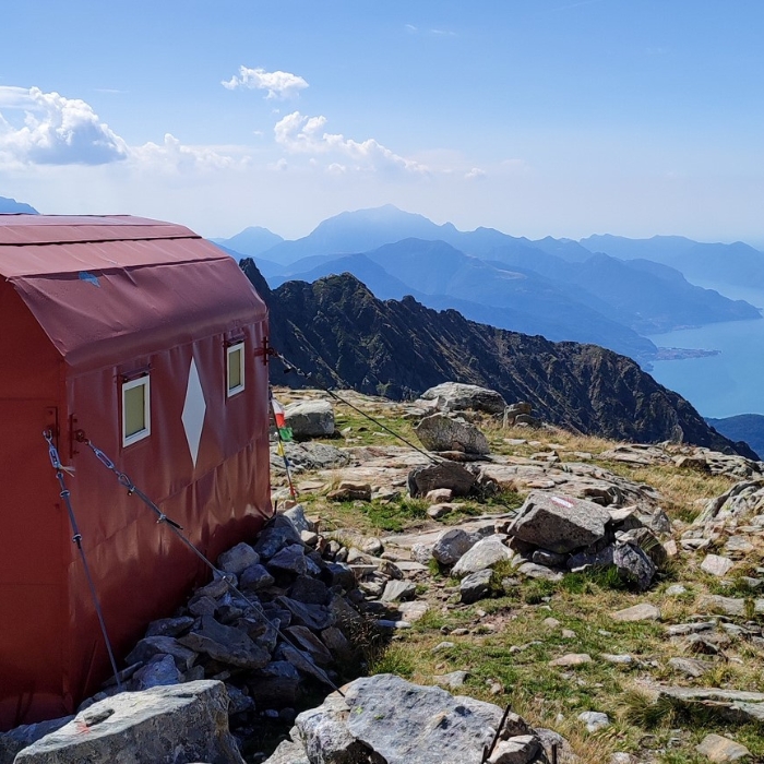
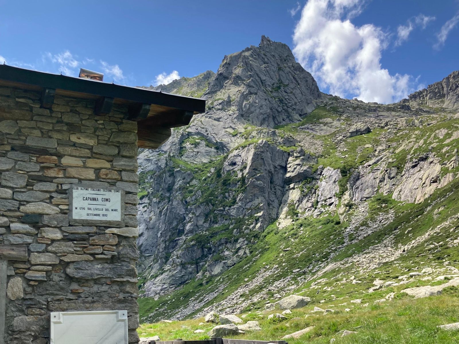
From here, a spectacular view opens up: Lago di Darengo lies nestled in a vast natural amphitheater, with Capanna Como, our destination for the day, visible in the distance.
The descent requires concentration: in about one kilometer, we lose 400 meters of elevation down to 1,790 m at Capanna Como. Finally, we can enjoy some well-deserved rest. If the August heat lingers, a dip in Lago Darengo is the perfect way to refresh.
The day ends with the magic of the evening at the refuge: dinner is prepared, we admire the starry sky, toast to the completion of the first stage, and relax into a well-earned rest.
DAY 2:
15 km | 1,500 m D+
We greet the dawn, have breakfast, and are ready to set off again. The day starts immediately with a climb to Passo dell’Orso (2,141 m), then descends along the slopes of the upper Valle del Liro to Schiena di Mogn: a long, imposing ridge that rises before us like a wall, culminating at the summit of Mater de Paia (2,482 m).
To cross it, we tackle an equipped section, well-prepared but steep and “fun,” offering adrenaline and great satisfaction. Once over the ridge, we descend to the opposite side, where about 100 meters below lies the scenic Bivacco Zeb—a spot worth visiting on a future trip.
We then return to the main trail, climbing steadily to Passo di Naav (2,397 m), just below the summit of Monte Cardinello (2,520 m). From here, we start descending toward Alpe Malpensata (1,882 m), entering the Swiss section of the Alta Via.
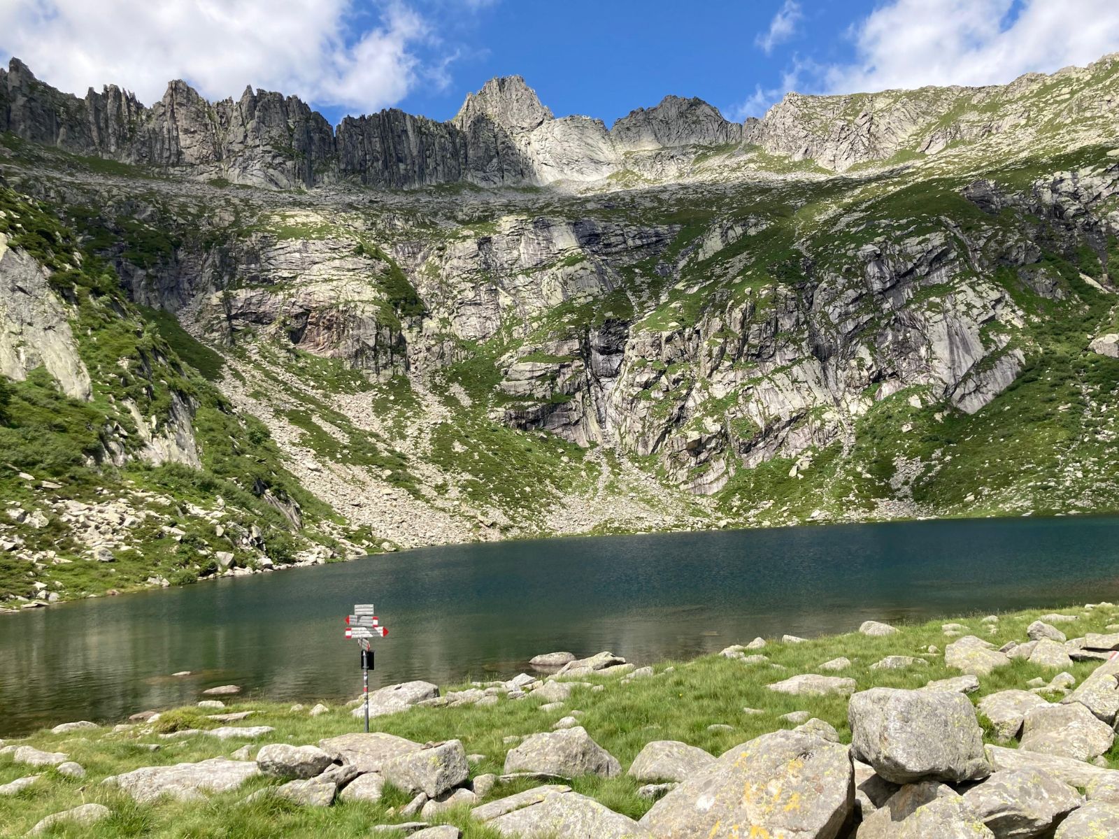
We cross Alpe di Rogg, where an old, abandoned bivouac stands, ascend to the Laghi di Roggio (1,950 m), and after Bocchetta di Stazzona (2,122 m), return to Italy.
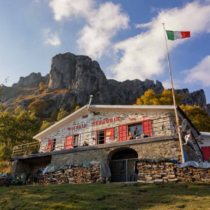
We are now approaching the end of the stage: Rifugio San Jorio (1,984 m) comes into view. All that remains is to reach it and be welcomed by the passionate volunteers of Operazione Mato Grosso, who manage the refuge. A refreshing beer, a rejuvenating shower, and a well-deserved dinner await after another intense day on the trail.
DAY 3:
24 km | 1,300 m D+
At dawn, after breakfast, we set off with determination: the longest stage of the Alta Via awaits, less technically demanding but still intense in terms of distance and elevation.
From Passo di San Jorio (2,010 m), a ritual photo at the little chapel is a must. Then we start covering kilometers along the comfortable military mule track that leads to Rifugio Sommafiume. Here the trail becomes steeper: it crosses the slopes below Pizzo di Gino (2,245 m), continues to Cima Pianchette (2,167 m), skirts Monte Tabor (2,080 m) and Monte Marnotto (2,088 m), and finally reaches the base of Monte Bregagno (2,107 m).
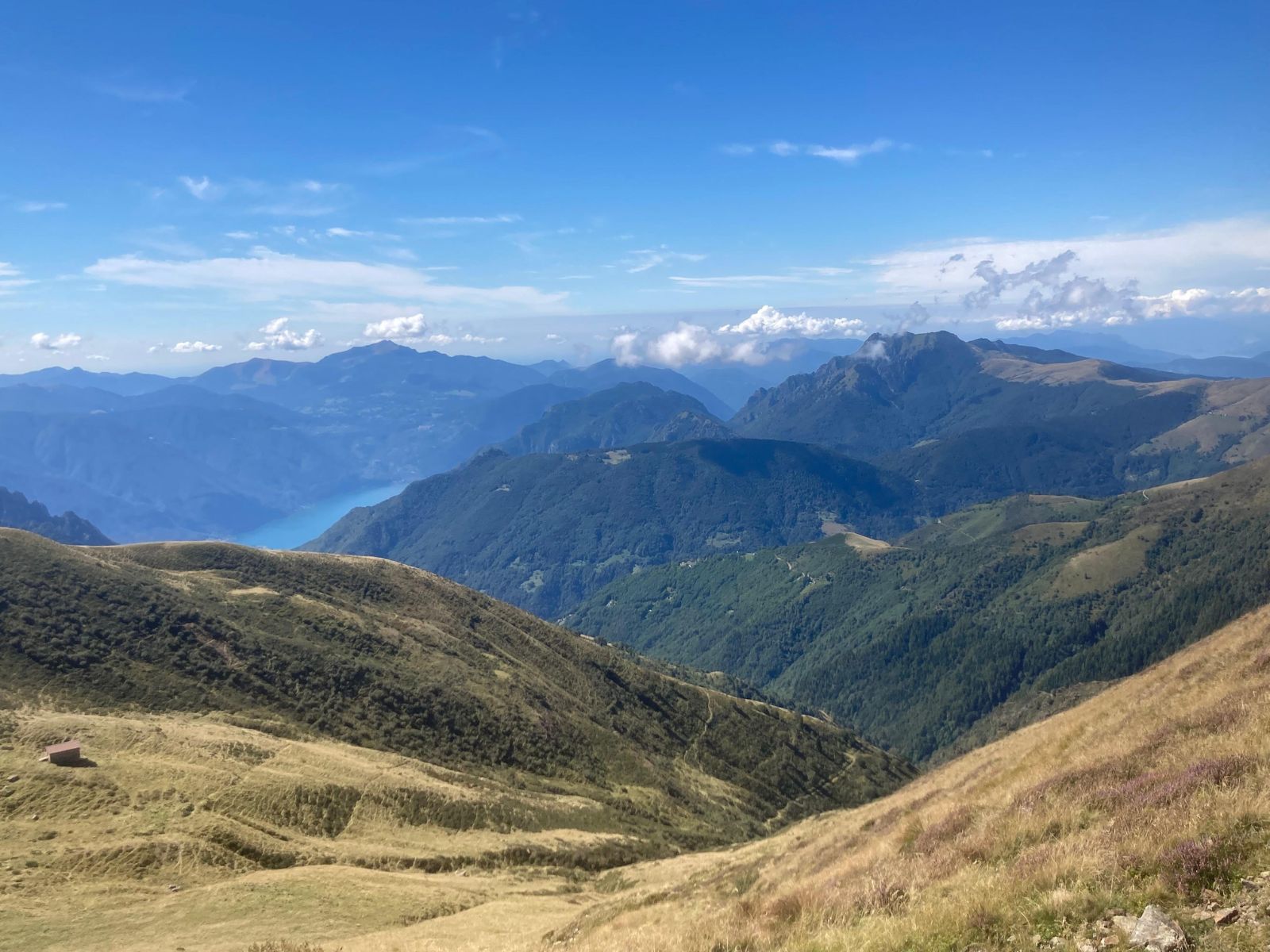
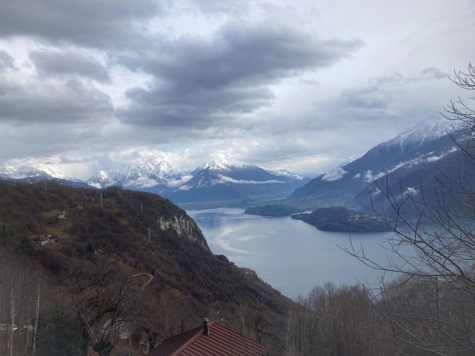
It’s a long, panoramic ridge walk, constantly rewarding, with Lake Como almost always visible in the background. We pass Bregagnino (1,905 m), go by the Oratory of Sant’Amate, and begin the descent toward Rifugio Menaggio (1,355 m).
Here we allow ourselves a quick beer to toast our achievement before tackling the final effort leading to Monti di Breglia, where the cars await for the return journey. One last look at the mountains we’ve traversed, and this intense Alta Via del Lario adventure comes to a close.